Sustainability Plan, Uppsala, Sweden

Uppsala, Sweden, is the fastest-growing and fourth-largest city in Sweden. As a result of its popularity, it has faced housing shortages and other growing pains. The city is seeking to address these issues sustainably through its green policies, with a pledge to be fossil-fuel-free by 2030 and climate positive by 2050. The Uppsala Climate Protocol brings together 42 local businesses, public agencies, associations, and the city’s two universities to meet its climate challenge. Many of these stakeholders are involved in creating the Uppsala Climate Roadmap, which will create a concrete guide on how to phase out fossil fuels. 

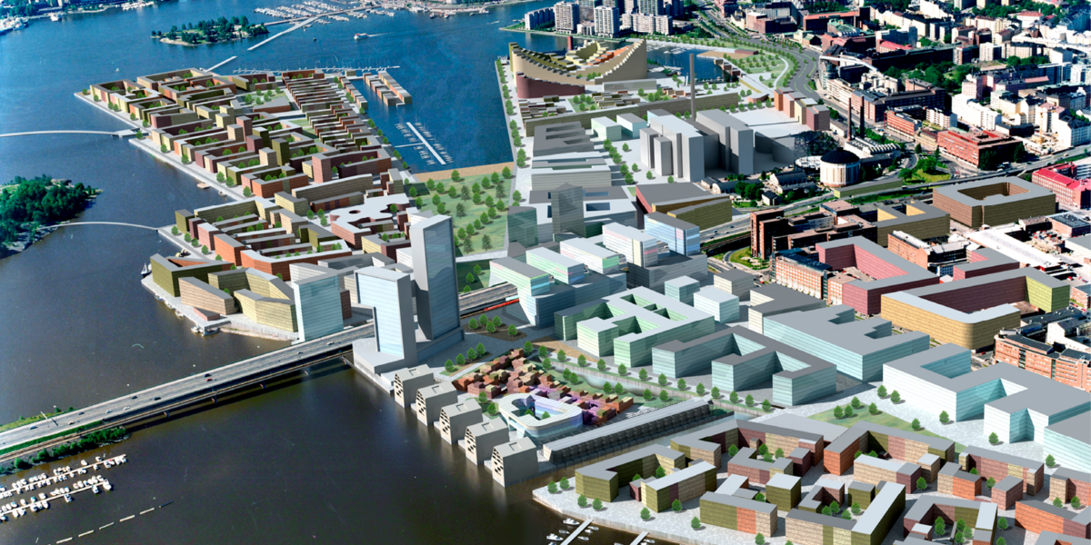
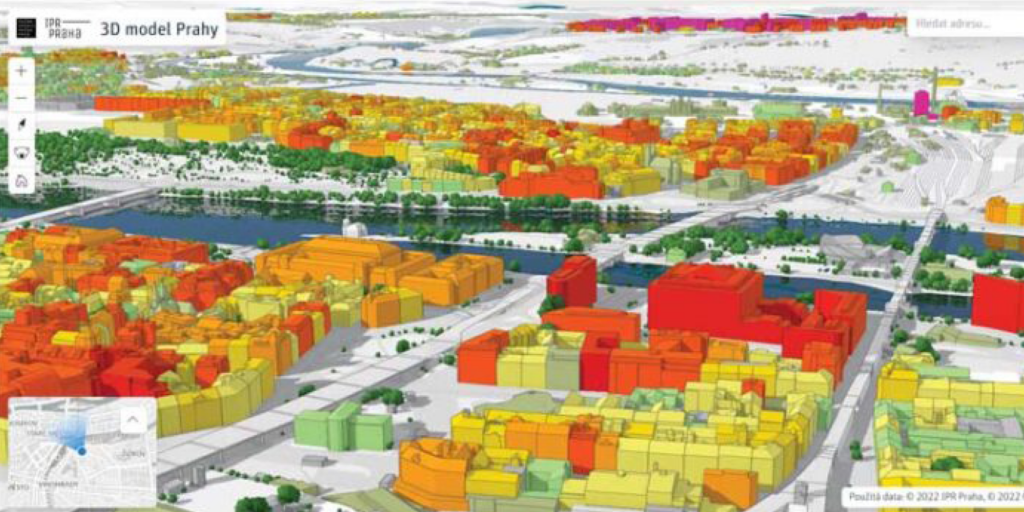
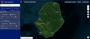
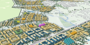
The Uppsala Climate Protocol guides key development decisions that planners use to design green development. Uppsala planners are creating a new, green district using a sustainable urban model with a detailed zoning plan and a 3D model built with Esri’s ArcGIS Urban. This software helps the planners visualize and present plans for the new city district that adds to residents’ quality of life, doesn’t subtract from biodiversity or degrade the environment, and cuts carbon emissions. It supports the planners’ efforts to maximize green space, retain trees and the natural environment, and update traditional city infrastructure management —such as water, wastewater, transport, and energy systems—to be more natural and energy efficient. In addition, the interactive and open 3D model allows anyone to view what has been planned. An online planning site with modeling enables stakeholders and residents alike to provide feedback early on in the planning stages to optimize the response.

Digital Synergy Project, Helsinki, Finland

As the City of Helsinki faced modern challenges such as increased urbanization and climate change, its government realized the need to go beyond traditional planning techniques to best serve the community and meet Finland’s goal of carbon neutrality by 2035.

The city government launched a EUR 1 million project to produce a digital twin of the city to improve Helsinki’s internal services and processes, promote smart city development, and share city models as open data to citizens and companies for research and development. The Helsinki 3D open data platform now supports many initiatives to improve sustainability and quality of life with a city-scale digital twin.

Bentley is utilizing an open platform to integrate existing city models and support internal processes and public services to be carbon neutral by 2035. This platform tests smart city initiatives, including 3D modeling, data use, and energy efficiency. The 3D models analyze the utilization of solar power, flood assessments and noise calculations. Helsinki’s digital twin is used to share open data for simulations, visualization, collaboration and engagement for all stakeholders, including the general public. The software platform enables better decision-making by connecting the right information to the right stakeholder.

3D Mapping, Prague, Czech Republic

An urban design competition focused on turning an area with heavy industrial and extensive transportation infrastructure development into a vibrant neighborhood that would restore its connection to its historical past, ensure its climate resilience, and preserve it as a UNESCO world heritage site. Prague, one of Europe’s fastest-growing cities, faces an ongoing challenge to reconcile development and preservation. Urban development trends in the Czech Republic’s capital are driving towards creating a city that is more accessible to pedestrians and improving the city’s livability.

3D Model of Prague

In recent years, the Prague Institute of Planning and Development (IPR Prague), Prague’s central policy-making unit for urban architecture, planning, development, design, and administration, has taken a special interest in determining how climate change will affect and alter the city. The city’s digital twin helps new development strike the right balance between efforts to address climate pressures and changes that improve the lives of residents. City planners have constructed 3D models of Prague’s microclimates using Esri’s ArcGIS. These models provide a way to simulate the effect of adaptation and mitigation strategies before they are implemented.

Digital Twinning a Country, Singapore

The Singapore Land Authority (SLA) is creating the first digital twin of an entire country to advance the nation-state’s efficiency and sustainability. Singapore is seeking to maximize its land use and create a comprehensive flood risk assessment as one of the world’s most densely populated countries, with nearly 8,000 people per square kilometer and over five million inhabitants.

3D Reality Mesh and the Mapping Cloud of Three Different Locations in Singapore

In 2012, SLA began creating a 3D map of the entire country and later developed Virtual Singapore, a digital twin using software provided by Bentley Systems. The mapping teams used laser-scanning aircraft and car-mounted sensors to record terrain and surface information and street-level mapping at a 1cm resolution, using more than 160,000 images and 25TB of data. Bentley combined these data sets into a single platform, allowing multiple government agencies to view and verify information and help inform and improve urban planning and design. The created data set is to be leveraged by nine government agencies to support engineering and crowdsourcing activities.

Singapore is expanding its digital twin by mapping the city’s sub-surface and underground utilities. Singapore’s digital twin is an innovative digital transformation that enables the country to respond to natural disasters, monitor polluting transportation and improve pedestrian flows, enhance building efficiency and sustainability, map potential solar projects to meet its alternative energy goals (with a target to deploy at least 2 GWp of solar energy by 2030), and better plan future green and gray infrastructure projects.

Virtual Gothenburg, Sweden

Virtual Gothenburg, is a partnership between the city, Chalmers University, Esri, and others. It incorporates ecologically, economically and socially sustainable data and acts as a platform for planning, monitoring and maintenance and as an open testbed for innovation. As the second largest city in Sweden, Scandinavia’s largest port, and a frontrunner in sustainability, Gothenburg uses its 700 sq km digital twin to understand historical data, use real-time data to control and regulate its infrastructure and simulate scenarios to predict future impacts to the city.

Using Esri’s CityEngine software, new data was collected and categorized for this project, including a detailed and comprehensive inventory of city buildings- including attributes such as rooftop materials, the number of floors, what kind of windows it has, or the year of construction; streets and street-level data such as lampposts or benches; tree inventory and more. These models were then used with a gaming engine to generate a virtual or simulated version of the city in real time. Testing future scenarios in the digital twin can help predict outcomes from storms, flooding, or population growth to learn and build a more sustainable city.

The Smart City of Siemensstadt, Berlin, Germany

Bentley Systems and Siemens are collaborating on a massive project in Berlin, developing an entire city district of over 70 hectares called Siemensstadt Square. The modern urban district will be occupied by industrial operations, commercial activities, research, education, and social infrastructure by 2035.

The project utilizes a digital twin of the city that enables every stakeholder, from engineers and architects to surveyors and construction workers, to collaborate and connect, combining data types to better design, build, and operate the infrastructure facilities. The digital twin and the software managing it allow users to visualize, simulate and optimize all the project’s assets – including roads, utilities, and buildings – during the planning phase before construction begins. It then enables stakeholders to improve decisions and outcomes, including meeting the district’s carbon-neutral objectives and evaluating whether it meets its environmental, social and governance (ESG) and sustainability goals. The web-based platform is 3D, immersive and available in real-time, connecting data and users to maximize collaboration and interoperability.