Let’s Expand Humanity’s Vision of the Future
Jack Dangermond, Chair – Patron Board, WGIC
I vividly remember the day I first saw the picture of Earth from the Moon in a magazine – this tiny planet of ours flying around in an expansive universe. It set me thinking. Our Earth is not only beautiful but also a living, sentient being. It is a fragile, complex, and interconnected system. It holds all of humanity’s history and our experiences from the beginning – an extraordinary aspect.
Today, our world is evolving rapidly and is increasingly influenced by human activity. This has led to some interesting challenges.
It’s not all bad news, though.
Over the past few hundred years, we have seen many ingenious innovations—in agriculture, transportation, energy systems, computing, information communication technology, and healthcare—that have greatly improved the quality of life, and we aspire to go even further.
However, our progress has come at a cost. The recent World Economic Forum’s Global Risks Report features “extreme weather events” among the top risks the global population will face in the short term (two years) and long term (10 years). The report says climate change, along with other threats, is set against a backdrop of rapidly accelerating technological change and economic uncertainty.
Our actions are creating unintended consequences. We are living carelessly beyond our means, which could leave the planet unsustainable and inhospitable for future generations.
It will take everybody understanding and collaborating around that understanding to overcome these challenges. It requires bringing together the best of our information, science, technology, creative innovations, and systems thinking.
It requires uniting around this foundational and powerful science of the world we have – geography – and, on that note, geospatial technology. By organizing all human experiences, geospatial technology helps us see the world holistically. It reveals patterns and relationships and gathers insights into events otherwise hidden in plain sight. This potent technology and data bring clarity and make complexity understandable.
Further, geospatial technology integrates geographic knowledge into everything people do. This geographic approach provides a framework and a process for collecting, measuring, visualizing, and finding holistic solutions that support decision-making and action.
At the same time, it is improving how we collaborate to solve the complex challenges the world faces. It is facilitating a geospatial infrastructure, which in turn is transforming how we work together, sharing resources, content, maps, data portals, models, workflows, and even infrastructure.
The World Geospatial Industry Council (WGIC) and our members pulse with this shared vision, exemplified through its mission and initiatives to expand the value proposition of geospatial technology and to facilitate collaboration to develop innovative solutions to adequately address the complex challenges of the world. I believe geospatial professionals have an enormous role in creating the future we want.
As we continue doing our work, remember our work is part of something much more significant, creating and influencing the future of our planet.
I recently came across a poem by Ralph Waldo Emerson, written a century and a half ago –
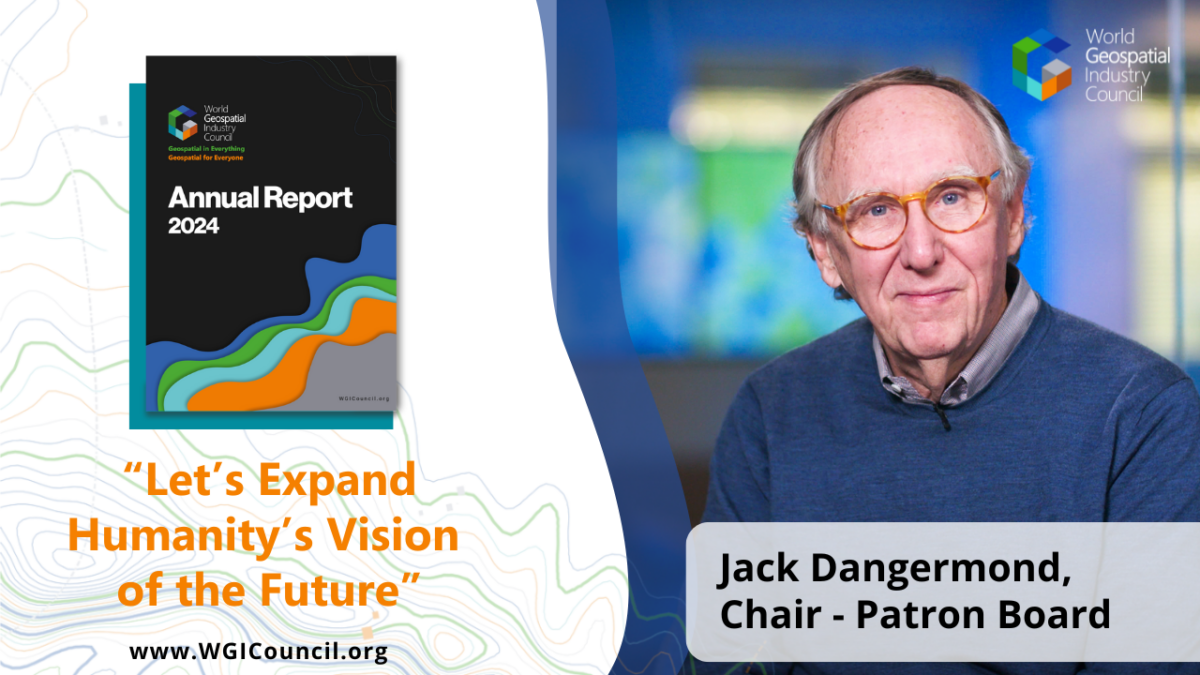
“Among the map-makers of each generation are the risk-takers…those who see the opportunities, seize the moment…and expand humanity’s vision of the future.”
I thought he was talking about us, the geospatial people.
As a community, let us leverage the power of geospatial to do precisely what Emerson said – unite our world and create a better future.